Very High Resolution imagery
Detailed Earth Observation data
The demand for data accuracy increases from project to project. To meet the requirements of our users, we have gathered suppliers of very high-resolution (VHR) images.
Thanks to the variety of products, together with our users we can choose the best possible solution. Commercial satellite data is a perfect match in the projects which require a more detailed area of interest or there is a need to fulfill the Copernicus data.
EODATA+, VHR satellite data
Like in the Copernicus mission, the data provided may be available in different variants in commercial satellites. Users can take advantage of multispectral data, night and radar images, as well as the possibility of obtaining video recordings in 4K resolution.
VHR satellite images have many industrial applications and provide huge amounts of spatial information for the military, land resources, agriculture, transport, and urban economy.
In order to diversify and fully open up opportunities to our customers, we have established cooperation with various suppliers so that everyone can find the ideal solution for their project.
VHR commercial data providers
The market for satellite imagery is constantly growing. Like any commercial segment, this one is also enriched with ever better solutions. Knowing the demand of customers, we want to offer a variety of types of this service. Below we present our partners from all over the world who provide “products from orbit” for us and our customers:

Airbus

CG Satellite

KG Space
Technology

SI IMAGING
SERVICES
Airbus
Airbus Defense and Space is a leading supplier of complete satellite systems
Earth observation. Airbus offers access to imagery sourced by constellations
optical and radar satellites, which are characterized by very high resolution
- spatial and temporal - a short visit period, some satellites are found twice
during the day in the same place on Earth.
Available data from Airbus offer:
- Pléiades 1A & 1B
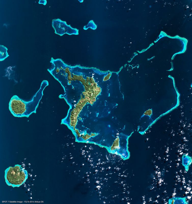
- Spot 6/7
- Vision-1
- Radar constellation (TerraSAR-X,TanDEM-X, PAZ)
- SpotMaps1.5 & 2.5
- Elevation 30
- Elevation 1/4/8/10
- WorldDEM
- GCPs
- DMC Constellation
- SMART Report
OneAtlas:
- Living Library
- WorldDEM Streaming™
- Basemap
| CONSTELLATION | PRODUCT TYPE | SPATIAL RESOLUTION | REVISIT CYCLE | SPECTRAL BANDS |
|---|---|---|---|---|
| Pléiades 1A i 1 B | Optical |
Panchromatic: 50 cm |
Twice a day |
Panchromatic: 480-830 nm |
| Vision-1 | Optical | Panchromatic: 90 cm Multi-spectral: 3.5 m |
Daily to 8 days depending on latitude and partner satellites |
Panchromatic: 450-650 nm |
| SPOT 6/7 | Optical | Panchromatic: 1.5 m Multi-spectral: 6 m |
Daily |
Panchromatic: 455-744 nm |
RADAR CONSTELLATION: TerraSAR-X, TanDEM-X, PAZ
| MODE | POLARISATION | SPATIAL RESOLUTION |
|
Staring SpotLight (ST) |
Single (VV or HH) | 24 cm |
|
HighRes SpotLight 300 MHz (HS300) |
Single (VV or HH) | 1,1 m |
|
HighRes SpotLight (HS) |
Single (VV or HH) | 1,1 m |
|
HighRes SpotLight (HS) |
Dual (HH & VV) | 2,2 m |
|
SpotLight (SL) |
Single (VV or HH) | 1,7 m |
|
SpotLight (SL) |
Dual (HH & VV) | 3,4 m |
|
StripMap (SM) |
Single (VV or HH) | 3,3 m |
|
StripMap (SM) |
Dual (HH & VV, HH & HV or VV and VH) | 6,6 m |
|
ScanSAR (SC) |
Single (VV or HH) | 18,5 m |
|
Wide ScanSAR (WS) |
Single (VV, HH, HV lub VH) | 40 m |

Changguang Satellite Technology (CG Satellite)
Chinese operator of Jilin-1 constellation can provide different satellite products such from the archive
and new acquisition which can be tasked with chosen properties by the end-user.
Our first partner provides new tasking images and archival ones.
The constellation is one of the few to provide standard luminous
(nighttime) images as well as 4K videos.
| DATASET | PRODUCT TYPE | SPATIAL RESOLUTION | REVISIT CYCLE | SPECTRAL BAND |
|---|---|---|---|---|
| Jilin-1 | Optical |
Panchromatic: 1 m |
3 days |
Panchromatic: 612 nm - 794 nm |
Więcej informacji o Changguang i ich satelitach dostępne jest tutaj:
Sprawdź pełną specyfikację konstelacji:
changguang_satellite_company_profile.pdf (5.2 MB)

Kazachstan Gharysh Sapary (KGS Space Technology)
The operator of the Earth remote sensing space system of the Republic of Kazakhstan
and the high-accuracy satellite navigation system services of the Republic of Kazakhstan.
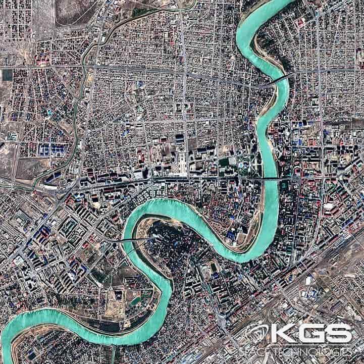
KGS provides images from KazEOSat-1 and KazEOSat-2. KGS also offers an online
archive platform for searching for products. KGS as a national operator of the Earth
remote sensing space system of the Republic of Kazakhstan provides consumers
with a wide range of geoproducts, services for the creation of geographic information
systems, geoservices, and navigation services.
| DATASET | PRODUCT TYPE | SPATIAL RESOLUTION | REVISIT CYCLE | SPECTRAL BAND |
|---|---|---|---|---|
| KazEOSat | Optical |
Panchromatic: 1 m |
3 days |
Panchromatic: 612 nm - 794 nm |
Więcej informacji o KGS i ich satelitach dostępne jest tutaj:
Sprawdź pełną specyfikację konstelacji:
kgs_company_profile.pdf (8.5 MB)

SI IMAGING SERVICES (SIIS)
The exclusive worldwide distributor of very high-resolution satellite imagery of Korean mission
KOMPSAT, series KOMPSAT-2, KOMSAT-3, KOMPSAT-3A and KOMPSAT-5.
A large group of satellite data users implements KOMPSAT imagery in many different areas,
as agriculture, environment, or crisis management.
| DATASET | PRODUCT TYPE | SPATIAL RESOLUTION | REVISIT CYCLE | SPECTRAL BAND |
|---|---|---|---|---|
| KOMPSAT (2, 3, 3A,5) |
Optical / SAR |
Panchromatic: 0.4 / 0.5 m |
1.4 days |
Panchromatic: 450 nm - 900 nm |
Więcej informacji o SI Imaging Services i ich satelitach dostępne jest tutaj:
Sprawdź pełną specyfikację konstelacji:
SI_IMAGING_KOMPSAT.pdf (540.5 KB)

